Soviet topographic maps
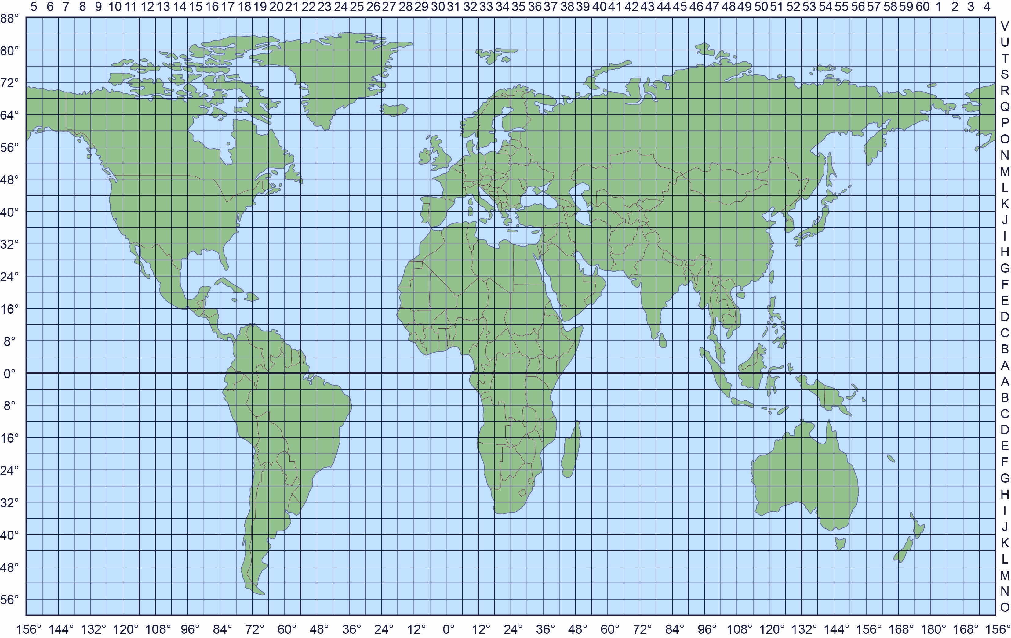
Map sheets are named in accordance with the International Map of the World (IMW) convention, having rectangles of 4 degrees of latitude by 6 degrees of longitude, identified by letters radiating north and south of the Equator and numbers west of east from 180 degrees.
Visual search to find and view map sheets
Available for North America between latitudes 24 and 60 and for the British Isles between the Channel Islands and Shetland
- Listing of all available sheets of North America
- Listing of all available sheets of British Isles
- Listing of all available sheets of Europe
Please read our General Information before ordering prints
Please address enquries to sales@redatlasbook.com
Go to General information, City Plans and other maps
Back to Red Atlas Home Page
Back to Soviet Maps Home Page